Mapping a Township/Range
1. Suppose that you know that Mr. Mathiot had a donation land claim in Oregon.
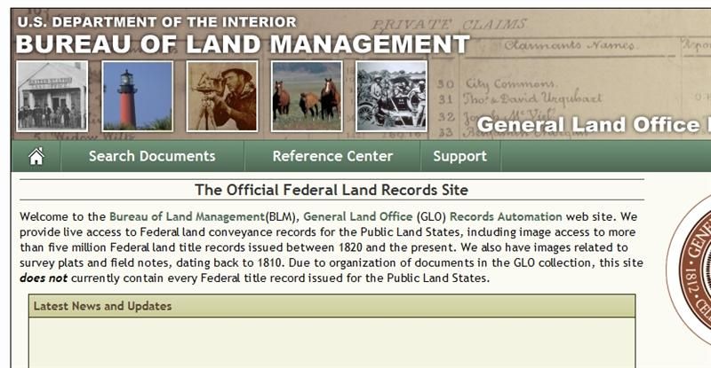
2. Go the the Bureau of Land Management site http://www.glorecords.blm.gov/
In the green bar, click on "Search Documents".
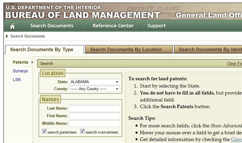
3. A form is shown with Alabama filled in, and all the rest of the fields uninitialized.
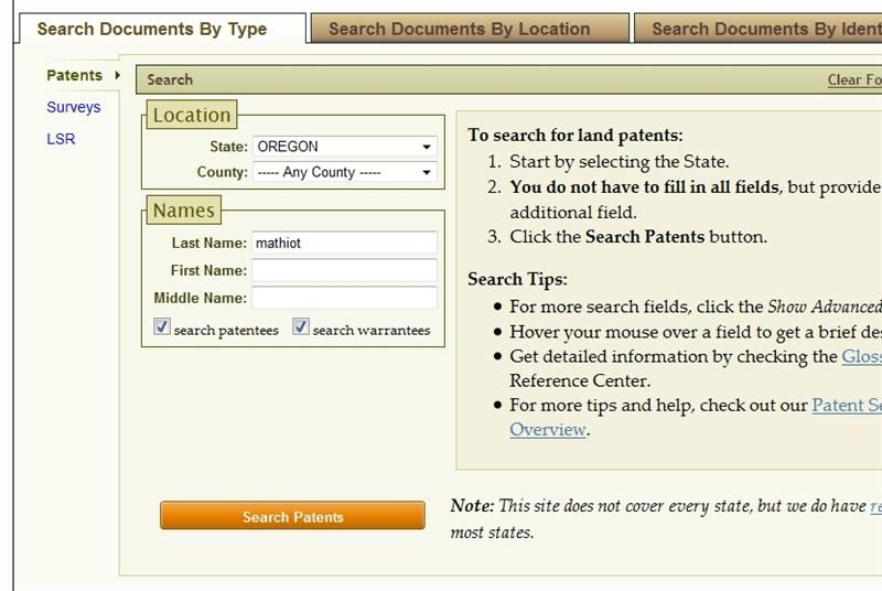
4. Enter enough information to find a land claim. Often a state and surname is enough. More information on searching is available at https://wiki.familysearch.org/en/Land_Patent_Search. You may have to scroll down to see Search Patents. Click on that.
5. The next screen shows summary information that will identify the land claim of interest. If you entered "Smith" or another common surname, you may have to choose carefully from the list. Now click on the accession number of your selected claim, in this case OROCAA 001190.
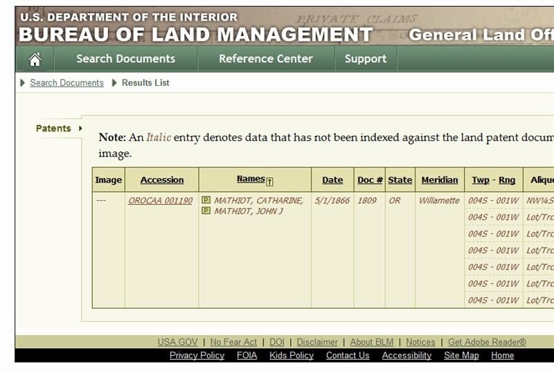
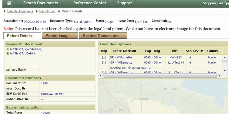
6. Here you see detailed information about the claim. On the right half of the display, note the Meridian, Township, Range, and Section Number. This will be useful for mapping. In this case, we have Willamette Meridian, Township 4S, Range 1W, Section 6.
7. The University of Oregon provides more information about maps and the Land Surveys at https://libweb.uoregon.edu/map/map_resources/about_glo.html.
It appears that in the future, the BLM site may show a map of the claim area. Until that happens, you can use Google Earth or Google Maps to locate a donation land claim.
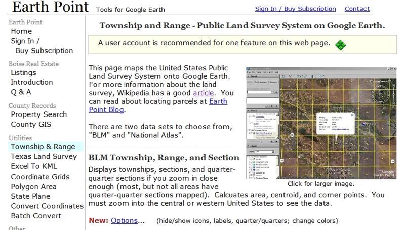
8. Go to the Earthpoint.us site http://www.earthpoint.us/Townships.aspx
9. Scroll down the Earthpoint page until you see the following form.
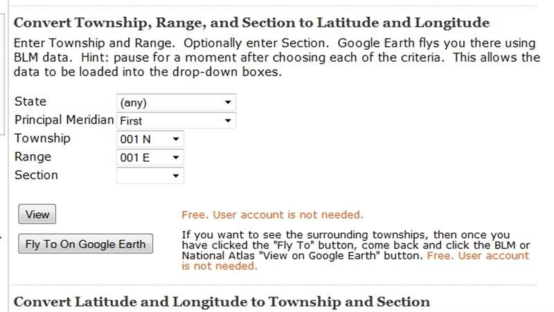
10. Fill in the State, Meridian, Township, Range, and Section that you noted from the BLM site. If you are searching in Oregon, the Willamette Meridian will fill in automatically after a few seconds.
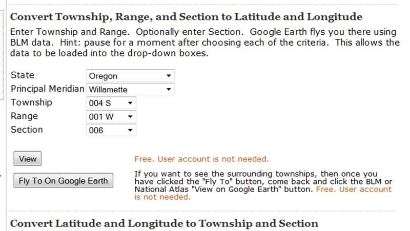
11. If you have Google Earth installed on your computer, simply click on the "Fly To On Google Earth" button. A one-mile square will be outlined identifying the section you searched for.
12. If you don't have Google Earth, you can use Google Maps. Click on the "View" button, then scroll down the Earthpoint page a bit to see the following.
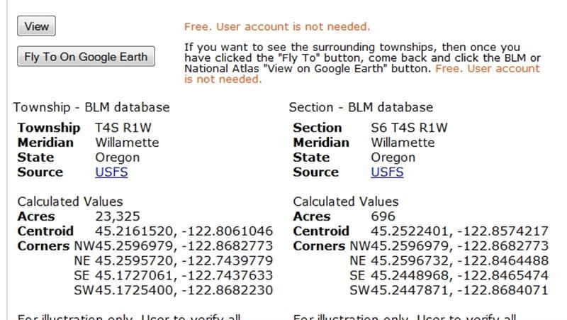
13. The left side shows GPS coordinates of the township. The right side shows GPS coordinates of the section. Highlight the coordinates titled "Centroid" and copy these to the clipboard (control-c).
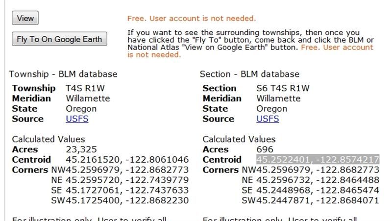
14. Now bring up Google Maps (http://maps.google.com/) and paste the coordinates into the search bar (control-v). Click on "Search Maps"
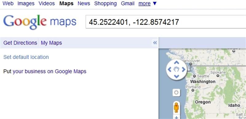
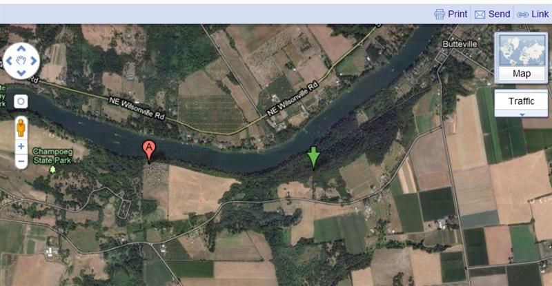
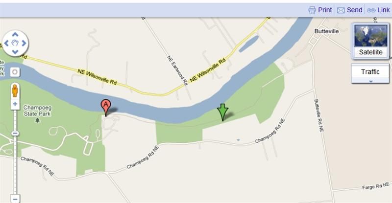
15. You will see a map with the center of the section identified by a green arrow. If, as in this case, the green arrow does not correspond to an actual address, the "A" location marker may point to a nearby address, not necessarily related to the land claim. To see an aerial view of the area, click on the satellite button in the upper right corner.
16. You can use all the usual functions of Google Maps, including zooming, street-view, and getting driving directions from your current location.